NASA’s latest Earth Observatory report documents how wildfire smoke spread around two prominent Cascade volcanoes during summer 2026. Photographs taken from the International Space Station show Mount Hood in Oregon and Mount Rainier in Washington partly obscured by smoke, offering a clear view of how fire activity can alter the atmosphere across a wide region.
The report was published on Aug. 13 as an Earth Observatory Image of the Day. It brings together two astronaut photographs acquired on July 31 and Aug. 4, along with NASA’s explanation of the fire conditions and wind patterns that shaped each scene. The images are observational records rather than forecasts, but they show why satellite and crew-based photography remain valuable for understanding the reach and visibility of wildfire pollution.
Two volcanoes, two smoke patterns
In the first photograph, Mount Hood appears near a broad plume rising from the Grasshopper fire east of the mountain. The smoke spreads across the surrounding landscape, reducing the contrast between the forest, valleys, and distant terrain. NASA identifies Mount Hood as Oregon’s tallest peak, rising 11,249 feet above sea level.
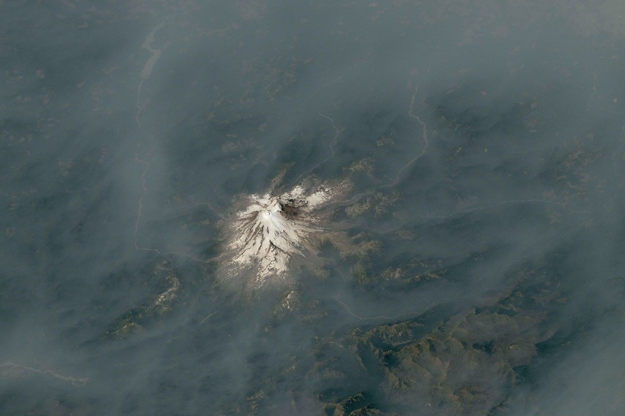
The second photograph shows Mount Rainier surrounded by smoke drifting from fires in central and eastern Washington. Unlike the Mount Hood scene, no major fire was burning immediately next to Rainier when the photograph was taken. The haze had travelled with the winds, demonstrating that the presence of smoke over a mountain does not necessarily identify the location of the fire producing it.
That distinction matters for interpreting photographs from orbit. A visible plume can reveal the direction and scale of atmospheric transport, but it does not by itself provide a complete measurement of air quality at the surface. NASA’s report notes that fine particulate matter had contributed to unhealthy air conditions in the region, while the photographs show the larger-scale movement of the smoke layer.
Why the images matter to Earth science
Wildfire smoke is not confined to the immediate area around a flame. Winds can carry particles and gases across state lines, while changing atmospheric conditions can concentrate or disperse the pollution. From the International Space Station, astronauts can capture the relationship between the smoke, the terrain, and the weather system in a single frame.
NASA says the photographs were taken with a Nikon Z9 digital camera using a 400-millimeter focal length. The images were later cropped and enhanced to improve contrast, and lens artifacts were removed. Those processing steps make the scene easier to interpret, but they do not turn the photographs into a direct pollution measurement. The pictures remain visual evidence of smoke distribution and landscape conditions at the time of acquisition.
The combination of a snow- and ice-covered summit with a brown-gray smoke layer also makes the environmental contrast unusually clear. Mount Rainier’s glaciers and Mount Hood’s high elevations provide fixed reference points, allowing observers to see how far the haze extends beyond the active fire zone. The photographs therefore complement, rather than replace, data from atmospheric instruments, ground monitors, and weather satellites.
What the report confirms—and what it does not
NASA’s publication confirms that astronauts photographed smoke around both volcanoes during late July and early August 2026. It also records the dates of the photographs, the camera system used, and the visual changes produced by the smoke. These details make the images traceable observations rather than anonymous illustrations.
At the same time, the photographs do not establish the exact concentration of pollutants at every location, determine the full health risk for communities, or predict how long the smoke will remain. Those questions require measurements collected at the surface and analysis of atmospheric transport. The value of the NASA report lies in its documented perspective: it shows the geographic scale of the event and places local fires within a wider regional pattern.
As wildfire seasons produce more episodes of dense smoke, this kind of reporting helps connect ground-level experience with the larger atmospheric system. A mountain hidden behind haze is not merely a striking image. It is also a record of how fire, wind, terrain, and human observation intersect. NASA’s photographs provide a verified snapshot of that process while leaving the limits of the evidence visible.