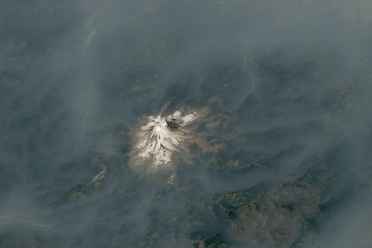
From orbit, wildfire smoke can turn a familiar mountain landscape into a study in atmospheric movement. New photographs taken by astronauts aboard the International Space Station show smoke surrounding Mount Hood in Oregon and Mount Rainier in Washington, revealing how fire conditions and regional weather shaped visibility across the Pacific Northwest.
In its latest Earth Observatory report, NASA describes the images as a contrast between fire and ice: glaciated volcanoes stand out against broad brown-gray layers of smoke. The photographs were made available through NASA’s astronaut photography program, which supports crew members in documenting Earth for scientific and public use.
Two volcanoes, two smoke patterns
The first photograph was taken on July 31, 2026, as the International Space Station passed over the U.S. West. It shows Mount Hood near a dense plume from Oregon’s Grasshopper Fire. NASA reports that the blaze began after a lightning strike on July 23 and had burned nearly 84,000 acres, or about 34,000 hectares, by August 12. The fire had also moved beyond national forest boundaries, while several communities in Wasco County faced urgent evacuation orders.
The NASA archive record for ISS075-E-1705 identifies the photograph as an astronaut image captured with a Nikon Z9 camera and a 400-millimeter lens. NASA’s archive lists the original resolution as 8256 by 5504 pixels, providing a detailed record of the scene beyond the cropped version used in the Earth Observatory article.
A second photograph, taken on August 4, shows Mount Rainier nearly surrounded by smoke. NASA notes that no major fire was burning immediately beside the mountain when the picture was taken. Instead, smoke had drifted from fires in central and eastern Washington under winds associated with a high-pressure system offshore. That distinction matters: the visible haze around a landmark does not necessarily identify the closest active fire.
According to NASA, the National Park Service reported unhealthy air quality at Mount Rainier that day because of elevated concentrations of fine particulate matter, commonly called PM2.5. The corresponding NASA photo record lists the image as ISS075-E-2221, taken from an altitude of roughly 409 kilometers.
Why the orbital view matters
Ground observers experience wildfire smoke locally, often through reduced visibility, a smell of burning material or official air-quality alerts. An astronaut’s view adds a different perspective. From several hundred kilometers above Earth, smoke appears as a regional pattern that can cross mountain ranges and spread well beyond the fire perimeter.
That perspective helps explain why conditions at a mountain destination may deteriorate even when the nearest visible fire is far away. Winds can transport smoke from multiple fires, while valleys, ridges and changing atmospheric layers can make the concentration vary sharply from one location to another. The photographs do not measure the amount of particulate pollution in the air, but they provide a clear visual record of the extent and direction of the haze.
NASA also cautions indirectly against treating an image as a substitute for operational monitoring. The photographs were cropped and enhanced to improve contrast, and lens artifacts were removed. They are valuable documentation, but they cannot determine a person’s exposure, confirm an evacuation boundary or replace local air-quality information and emergency instructions.
A continuing fire-weather concern
The report says above-normal fire potential was expected to persist across the Northwest through August. NASA attributes the difficult setup to warm, dry weather and cured vegetation, with conditions influenced by the developing El Niño pattern. These factors can make new ignitions more likely to grow rapidly, especially when lightning or human activity reaches dry fuels.
The same update also describes the Grand Park 2 Fire inside Mount Rainier National Park. Several days after the photograph was taken, the fire was observed about three miles north of the Sunrise Visitor Center. NASA reported that it had burned 223 acres, or about 90 hectares, by August 12 and remained uncontained, while its cause was still undetermined.
Those details place the images in a changing situation rather than a static landscape. A photograph can preserve the appearance of smoke over a volcano, but the fire perimeter, evacuation status and air-quality conditions may change quickly. Readers using the images to understand local risk should check current information from emergency-management authorities, park services and air-quality agencies.
What the photographs reveal
The two views show that wildfire smoke is both a fire problem and an atmospheric transport problem. Mount Hood appears close to a major fire source, while Mount Rainier demonstrates how smoke can arrive from elsewhere. Together, they make a simple point visible: the geography of a fire and the geography of its smoke are not the same.
NASA’s astronaut photography program makes these observations freely available, allowing researchers and the public to compare orbital images with ground reports and other Earth-observation data. In this case, the images connect a dramatic view of the Cascade Range with verified information about fire growth, smoke transport and unhealthy air. They are a reminder that the atmosphere can turn distant fires into a regional hazard long before the flames themselves are visible.