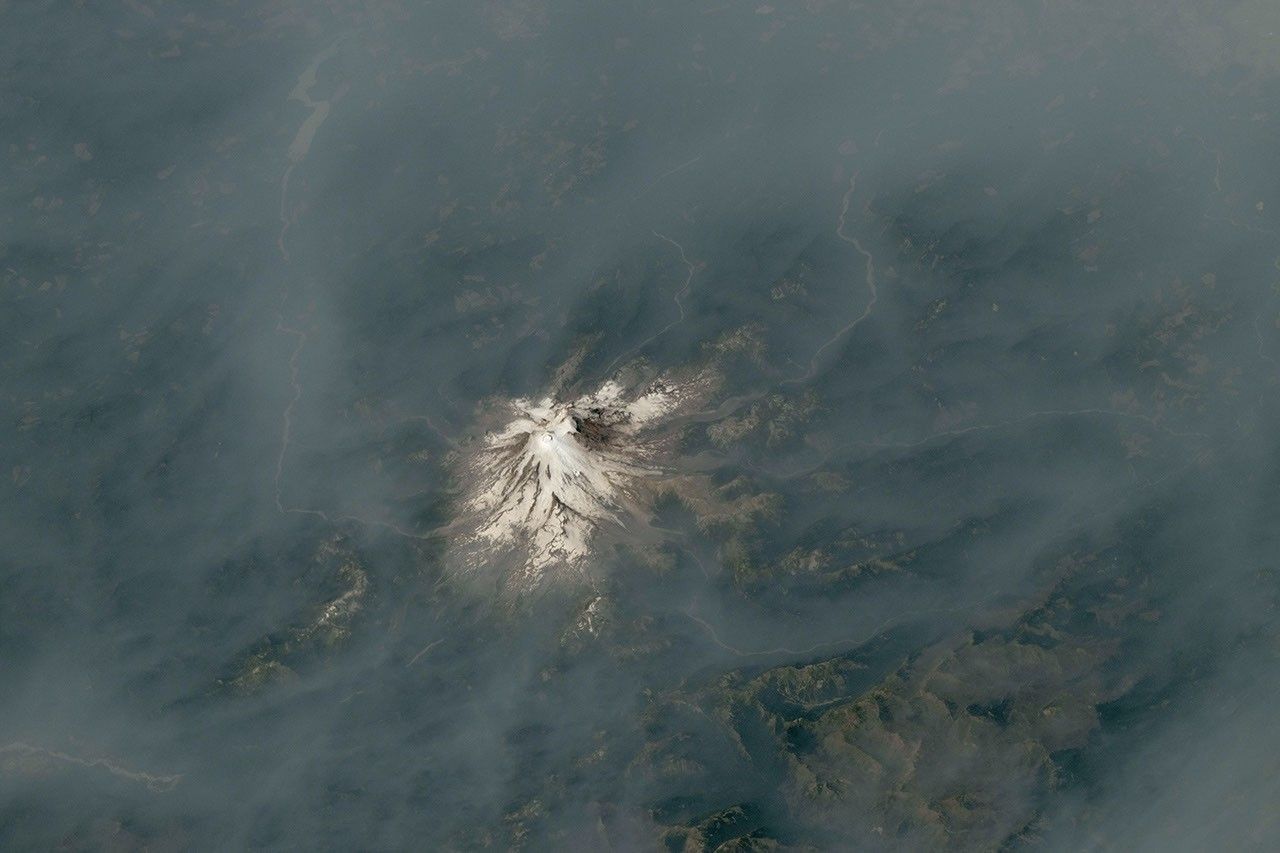
Two astronaut photographs from the International Space Station show wildfire smoke spreading around Mount Hood and Mount Rainier in the Pacific Northwest. Published by NASA Earth Observatory on Aug. 13, the images place active fires, glaciated volcanoes, and broad smoke plumes in the same frame.
The photographs were taken during summer 2026, when dry conditions and wildfire activity affected parts of Oregon and Washington. From orbit, the smoke appears as a brown-gray veil moving across the landscape, partially obscuring mountain slopes and valleys. The view is visually dramatic, but it also illustrates why satellite and astronaut observations are useful alongside measurements collected on the ground.
Two photographs, two different fire situations
The first image was taken on July 31 and shows Mount Hood, Oregon's highest peak, rising above smoke from the Grasshopper Fire. NASA reported that the fire had burned nearly 84,000 acres, or about 34,000 hectares, by Aug. 12. The blaze spread east and north across the Mount Hood National Forest after a lightning strike on July 23, and nearby communities faced evacuation warnings as conditions changed.
A second photograph, taken on Aug. 4, shows Mount Rainier in Washington surrounded by smoke drifting from fires in central and eastern parts of the state. NASA said air quality in the national park reached unhealthy levels that day because of elevated concentrations of fine particulate matter, or PM2.5. A separate fire, the Grand Park 2 Fire, was also burning within the park boundaries several days later.
NASA's article includes the original astronaut photography records from the Johnson Space Center Gateway to Astronaut Photography of Earth. The images were acquired with a Nikon Z9 camera using a 400-millimeter focal length. They were cropped and enhanced to improve contrast, with lens artifacts removed before publication.
What the orbital view reveals
Wildfire smoke is not a flat layer. It can rise, spread sideways, and travel hundreds of miles depending on wind, temperature, and atmospheric stability. An astronaut photograph cannot replace a local air-quality monitor, but it can reveal the regional scale of the event in a single frame. The smoke around the Cascade Range shows how a fire's effects can extend well beyond the visible flame front.
The photographs also show the contrast between persistent ice and rapidly changing fire conditions. Mount Hood and Mount Rainier remain recognizable because of their elevation and snow or glacier cover, while the surrounding lowlands are muted by smoke. That contrast helps researchers and the public understand how atmospheric conditions connect distant landscapes.
For people on the ground, the most important information is not the appearance of the plume but the concentration of particles in the air. The U.S. Environmental Protection Agency explains that PM2.5 particles can be inhaled deeply into the lungs and that the Air Quality Index translates monitoring data into practical health guidance. Anyone near a smoke-affected area should rely on current local air-quality alerts, public-health advice, and evacuation instructions rather than judging conditions from an image.
A fire season under elevated pressure
NASA noted that above-normal fire potential was expected to persist across the Northwest through August. The National Interagency Fire Center's August outlook also forecast above-normal significant fire potential across much of the Pacific Northwest, including Oregon and Washington.
Several factors contributed to the risk described by NASA, including warm and dry conditions, cured fuels, and thunderstorms capable of starting new fires. The agency also noted that seasonal conditions were influenced by El Niño. That does not mean a single climate pattern determines the outcome of every fire, but it can help shape the broader background in which ignition, spread, and smoke transport occur.
The ISS photographs therefore serve two purposes. They document a specific moment in an active fire season, and they show why Earth observation matters for environmental monitoring. Satellite instruments measure gases, aerosols, temperature, vegetation stress, and burned area at scales that are difficult to capture from the ground. Astronaut photography adds a human-scale visual record that can make those regional patterns easier to recognize.
Why the images matter now
Smoke events can change quickly as winds shift or fires intensify. A photograph taken from orbit is not a live warning and should not be used to decide whether travel, outdoor activity, or evacuation is safe. Its value is complementary: it provides context, while local agencies provide the current measurements and instructions needed for decisions.
NASA's images of Mount Hood and Mount Rainier show a familiar Pacific Northwest landscape under unusual atmospheric conditions. They also underline a practical lesson for a warming and fire-prone world: understanding an environmental hazard requires both a broad view from space and detailed information from the communities experiencing it directly.