
The U.S. Geological Survey released version 2.0 of the Cooperative National Geologic Map on September 3, 2026. It is the first digital map to provide standardized geologic data for all 50 states and most U.S. territories, extending the national coverage beyond the 48 contiguous states included in the August 2025 edition. The USGS announcement marks an expansion of both the map’s geographic reach and public access to geological information.
Alaska and Hawaii expand the national view
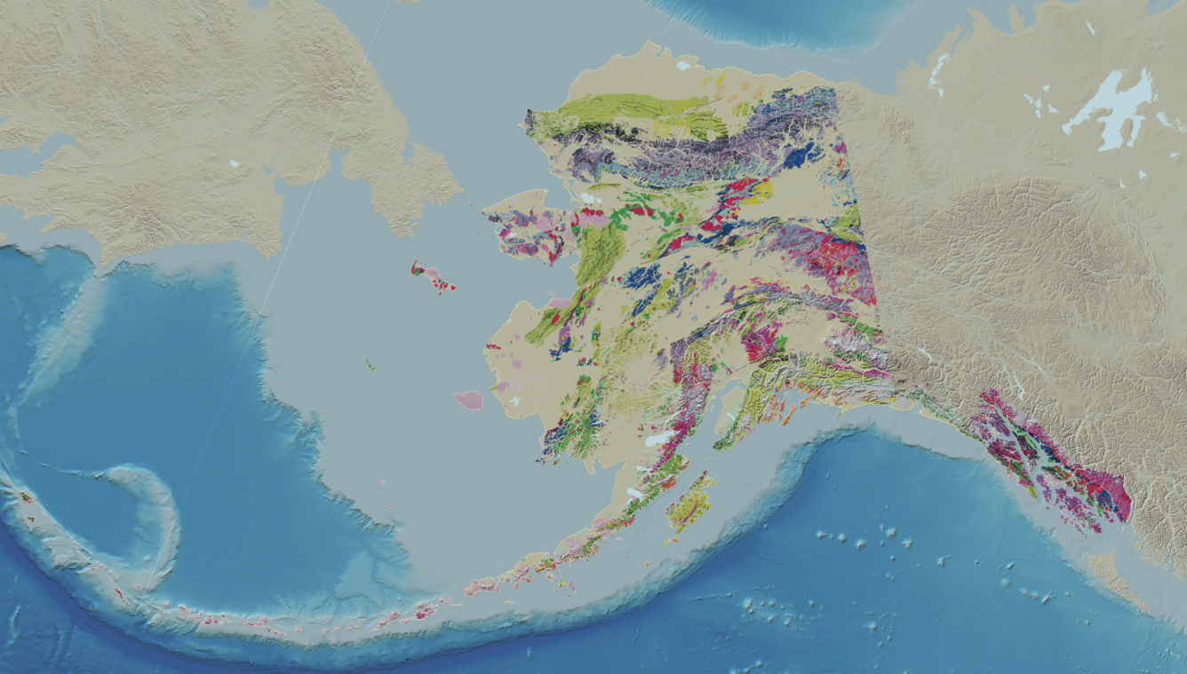
Version 2.0 adds Alaska and Hawaii, two major areas that were outside the first national release. Alaska’s data can be explored by geologic age, material and rock type, giving users several ways to examine the state’s underlying geology within the same national mapping framework.
Hawaii adds a different set of features to the resource. Its coverage includes basaltic lava flows, rift zones and areas exposed to volcanic hazards. These categories give readers a way to examine how the islands’ volcanic landscapes are represented alongside the geological information available for the rest of the country.
The territorial coverage is broader as well, although it is not uniform. Puerto Rico, the U.S. Virgin Islands and Guam are included in full. The Northern Mariana Islands and American Samoa are represented in part. That distinction qualifies the phrase “most U.S. territories”: the map has expanded substantially, but every territory does not have the same extent of coverage.
The same data structure supports new additions
Version 2.0 retains the standardized data format and the partnerships with state geological surveys used by the previous edition. The structure is supported by the Geologic Map Schema, or GeMS, published in 2020 by the USGS and the Association of American State Geologists. GeMS provides a common framework for regular improvements and further extensions of the national map.
The Wisconsin example shows the practical effect of that shared structure. After terminology was harmonized with the Wisconsin Geological and Natural History Survey, version 2.0 was able to incorporate a new Wisconsin geologic map in a matter of minutes. State-level mapping can therefore be brought into the national resource once its terminology matches the shared standard.
What readers can explore now
The map interface developed by the National Geologic Map Database allows the public to consult and explore information about the country’s geologic framework, resources and hazards. With version 2.0, Alaska, Hawaii and the listed territories can be examined alongside the contiguous states through one standardized digital resource.
The immediate change is practical: the geographic gap left by the 2025 release is narrower, while the data structure and partnerships supporting future updates remain in place. The territorial limits are still uneven, but the national map now offers a broader and more consistent starting point for exploring the geology, resources and hazards of the United States.